
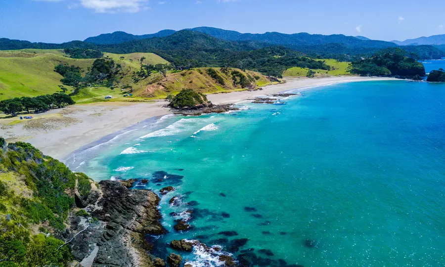
Duder Regional Park is located on the pōhutukawa-fringed Whakakaiwhara Peninsula, which extends out into the Tāmaki Strait. Visitors may feel like they are on their own island as they enjoy the 360-degree views extending to the Brookby/Maraetai hills, the Hunua Ranges and Hauraki Gulf islands.
How to get there
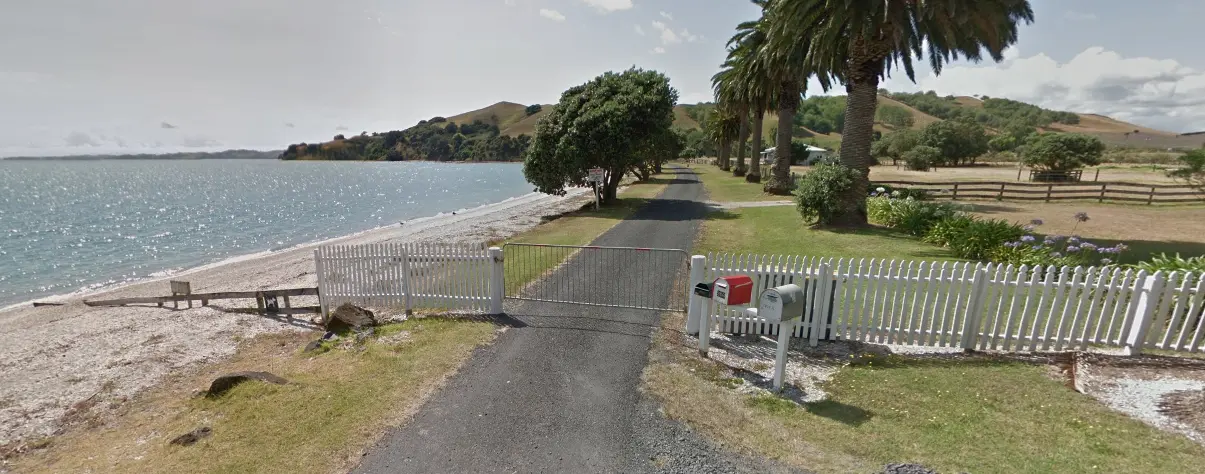
The main park entrance to Duder Regional Park is located at 933R North Road, Clevedon. This is 10km from the Clevedon Village or 5km from Maraetai.
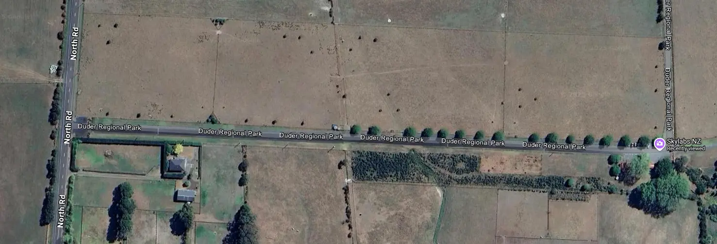
Please note: Bach users will need to use the shared drive off Maraetai Coast Road where it intersects with North Road. If you are not staying there, don't park your car anywhere at Maraetai Coast Rd as there is no entrance to the Regional Park.
Feature walks
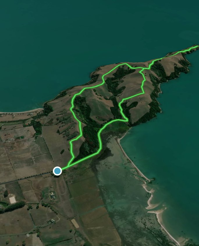
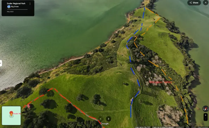
Let's look at the map below and I will show you the details of each track. Each main interaction has been marked with a number.
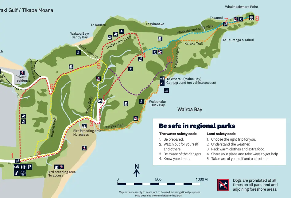
Source: https://www.aucklandcouncil.govt.nz/parkmaps/map-duder-regional-park.pdf
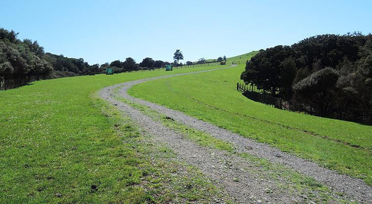
Duder Farm Loop (1-2-3-4-5-6-1)
Red marker, 4.2 km, 1-1.5 hours return
A good introduction for first time visitors to experience walking through gently rolling farmland with sheep and cows close by. Follow the red waymarker poles for amazing views. There are no steep hills or steps, so this is also the best circular loop for cyclists, horse riders and robust push chairs.
Kowhai Loop (2-3-5-6-2)
Yellow marker, 3.5km, 1 hr return
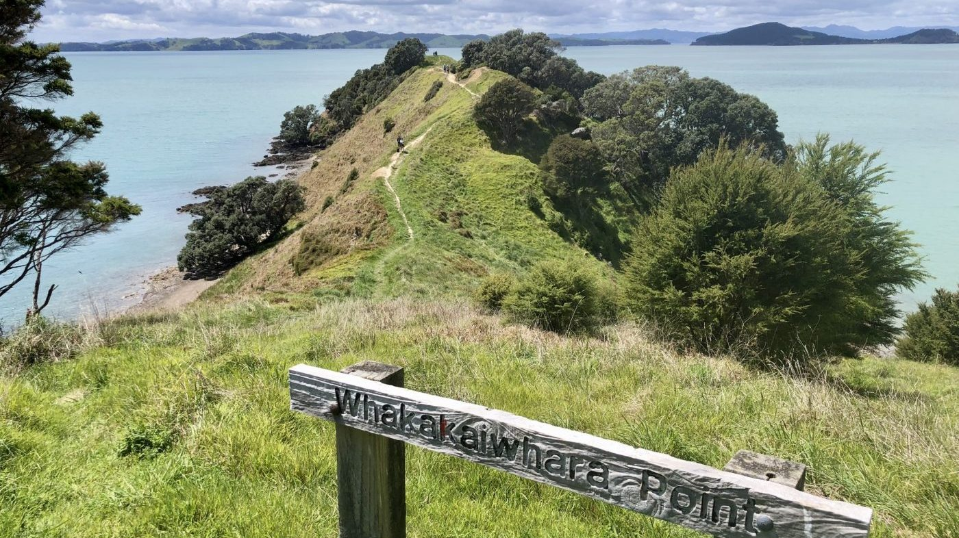
Whakakaiwhara Pā
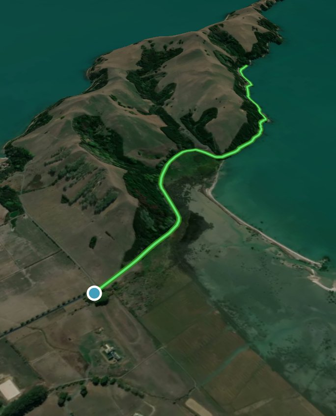
Blue marker, located at Point 8, so if you start from Point 4 oof the Duder Farm Loop, it will be 2.6 km/1 hr return (4-7-8). Or, if you start from Point 1 the carpark, it will be 5.5 km/2.5-3hrs return.
Halfway round the Duder Farm Loop the blue poles branch off and lead visitors east out to the end of the Whakakaiwhara peninsula to an old Ngāi Tai ki Tāmaki pā site. Here the extensive views over the Hauraki Gulf and into the Firth of Thames reinforce why this was such a good position for a defensive settlement; look closely and you will see the remains of the trenches that surrounded the pā, protecting if from invasion.
Karaka Trail (3-9-7-8)
Organge marker, 3.1km one way, 1 hour
From the car park follow the main road, opposite the entrance to Shady Gully, orange way-markers lead off to your right taking you along the south coast on Karaka trail. You will pass several lovely beaches, including Te Wharau beach where there is a basic campground for sea kayakers, and a toilet for those in need. Carry on along the beach for a couple a few minutes, keeping a keen eye out for the orange pole showing you where to start your trip back inland, up through Mangeao Valley and onto the ridge by the Eastern Red Barn. From there the orange poles continue out to the Pā, or, you can head back to the car park via the blue and then red poles.
Tawa Link
Purple marker, 1.3km from Point 5 to 9
This route links Shady Gully with Mangeao Valley and so by combining it with Shady Gully ( yellow ) and Karaka Trail (orange) you have a circular walk with the most shade in the park – perfect for a hot summer’s day.

Cycling
Cyclists are allowed on the Farm Loop and in the paddocks. They are not allowed on the bush tracks, namely Shady Gully, Mangeao Valley and Karaka Trail or past the last gate out to the pā site at the end of the peninsula..
A typical cycling route would be 1-2-4-7, park your bikes outside the last gate to the pa site and walk to the end. Come back from Point 7 and then 4-5-6-1.
Camping
Te Wharau/ Malua Bay Campground is one of the overnight options that make up the Te Ara Moana kayak trail. This remote camp site is only accessible by kayak or foot and those wanting to book must carry all equipment in and rubbish out. Campers have access to the wider park track network by heading south along the coast for 5 minutes and picking up the Karaka Trail as it heads up to the ridge via Mangeao Valley. Please take care when using cooking equipment and be sure to clear space away from long grass and flammable materials. Open fires are not permitted at any time within Regional Parks.
There are also 5 CSC campervans in the car park, at the end of the main entrance to Duder Regional Park.
Plants and animals
While much of the park is pasture, mature pohutakawa grow along the coast and remnant forest within the gullies. Native planting continues to extend bush cover throughout the park. Common species you may see around Duder include taraire, tawa, kanuka, puriri and karaka with the occasional remaining kauri.
Resident native birds include silvereye (tauhou), kererū, morepork (rūrū), tūi, fantail (pīwakawaka), grey warbler (riroriro) and kingfisher (kōtare). Inter-tidal mudflats around the park are important feeding and roosting areas for shore and wading birds such as pied shag (kāruhiruhi), white-faced heron, oystercatcher (tōrea), pied stilt (poaka), godwit (kūaka) and gulls (tarāpunga).
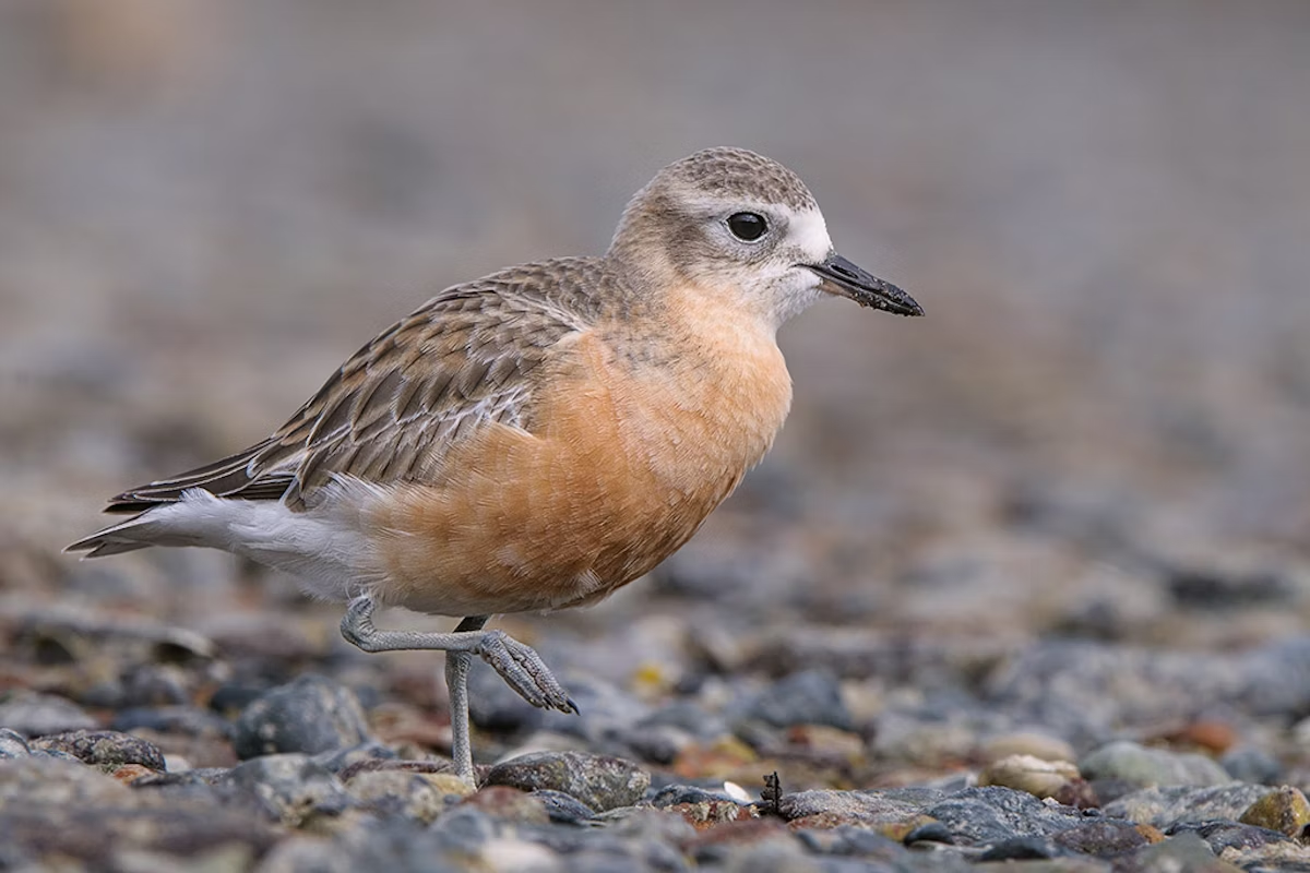
Small numbers of tūturi whatu, the New Zealand dotterel, breed on beaches around the park including the shell banks south of the park. There are only about 2000 of these birds in the world. The southern shell banks are not accessible to the public.
Orienteering
More information